Five Lessons from a Two-Month Tour of Washington State

In mid-June, from the northern tip of Lopez Island, my family and I drove our ProjectWA-branded RV onto a Washington State Ferry to begin a two-month exploration of the Evergreen State. After reflecting on our 2000-mile adventure, I would like to share a few of the lessons we took away from the experience.

1. We can live on less. Much less.

much less

There’s nothing like living for two months with three other humans in a 24-foot motorhome to remind you of how little we really need to survive. With no room for excess, everything was a ration: food, water, power, clothes and personal space. In some ways, all these constraints made daily life easier. With only the color of the day’s ProjectWA t-shirt to decide on, getting dressed was pretty straightforward. Bathing not so much. I regularly wondered by what order of magnitude my water consumption fell by being limited to 3-minute showers in state parks.

As we crisscrossed the state, we learned about the constraints under which people before us lived – long before the invention of the RV. When pioneers arrived via the Oregon Trail, everything they owned was packed into a four-foot-by-nine-foot covered wagon. Before American and European settlers showed up in the Pacific Northwest, native tribes maintained a much smaller footprint. Even the large plank houses of the Makah were a lot smaller than today’s average American home.

I’m not about to compare our RV lifestyle to that of the original peoples or American pioneers. After all, our motorhome was equipped with a microwave oven. No matter how one does it, I encourage everybody to force themselves to live on less for an extended period. The world would be a different place if everybody had to deposit 25 cents after every minute in the shower.

2. Washington state’s water has changed the world.

changing waters

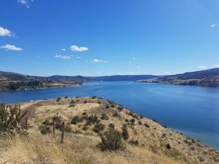
One look at Washington state on the map shows that water defines our existence – from the mouth to the Columbia to the upper reaches of Lake Roosevelt. This summer we learned how water dramatically changed the way of life for not only the inhabitants of the Pacific Northwest, but also the world. The Missoula Floods of the last Ice Age gave us the unique landscape we know today. David Thompson’s 12-day, 500-mile canoe trip down the Columbia River in 1811 helped create a global economy by completing a trade route across North America to Asia and Europe and back.

The hundreds of dams placed along our rivers over the past century transformed agriculture in the state and created a source of electricity that helped produce the first atomic bomb at Hanford. Those same dams wiped hundreds of small towns off the map and eliminated salmon runs that had been in place for millennia. Today, some of those dams – like the Elwha River Dam – are being removed, leading to even more dramatic changes to the ecosystems surrounding them. Some of the most significant events in world history can be linked to the water that flows through Washington state.

3. Washington is incredibly diverse.

diversity

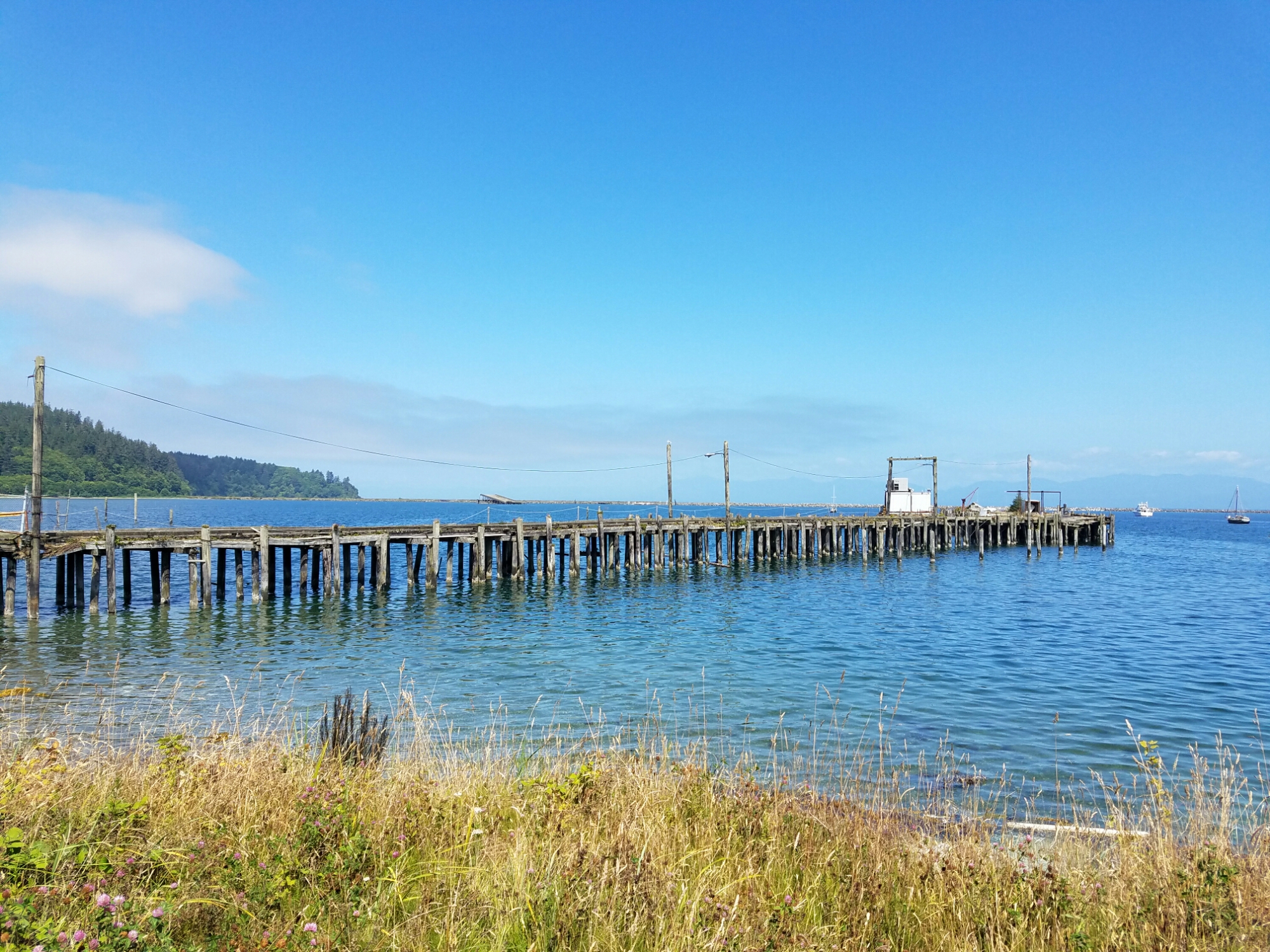
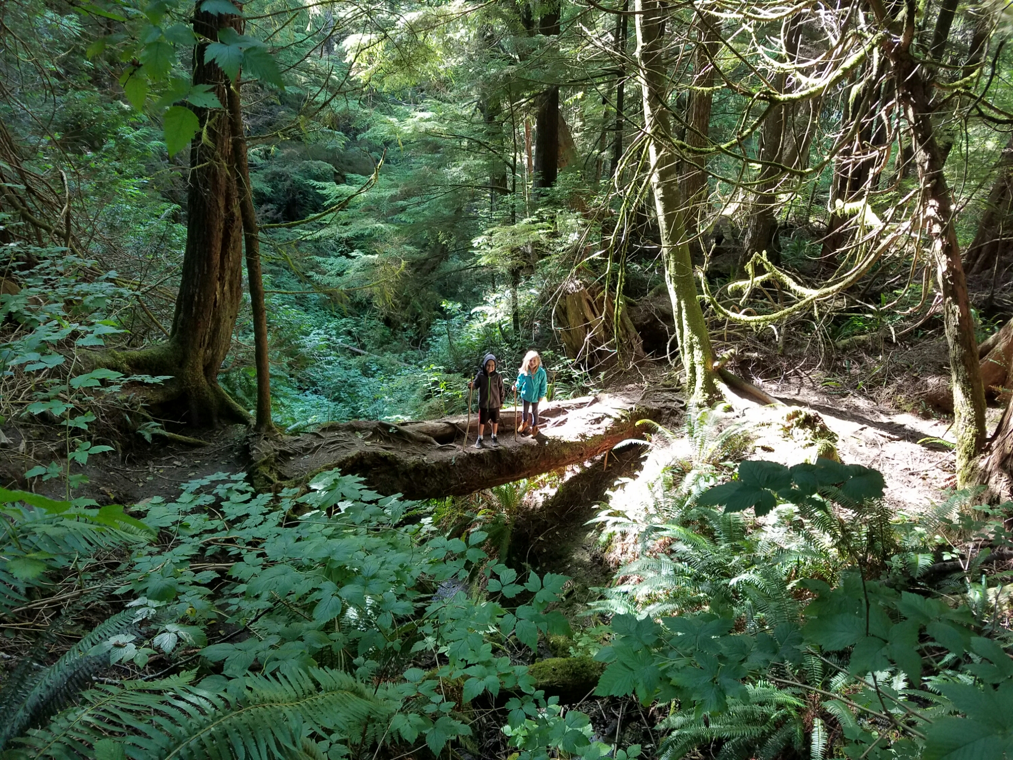
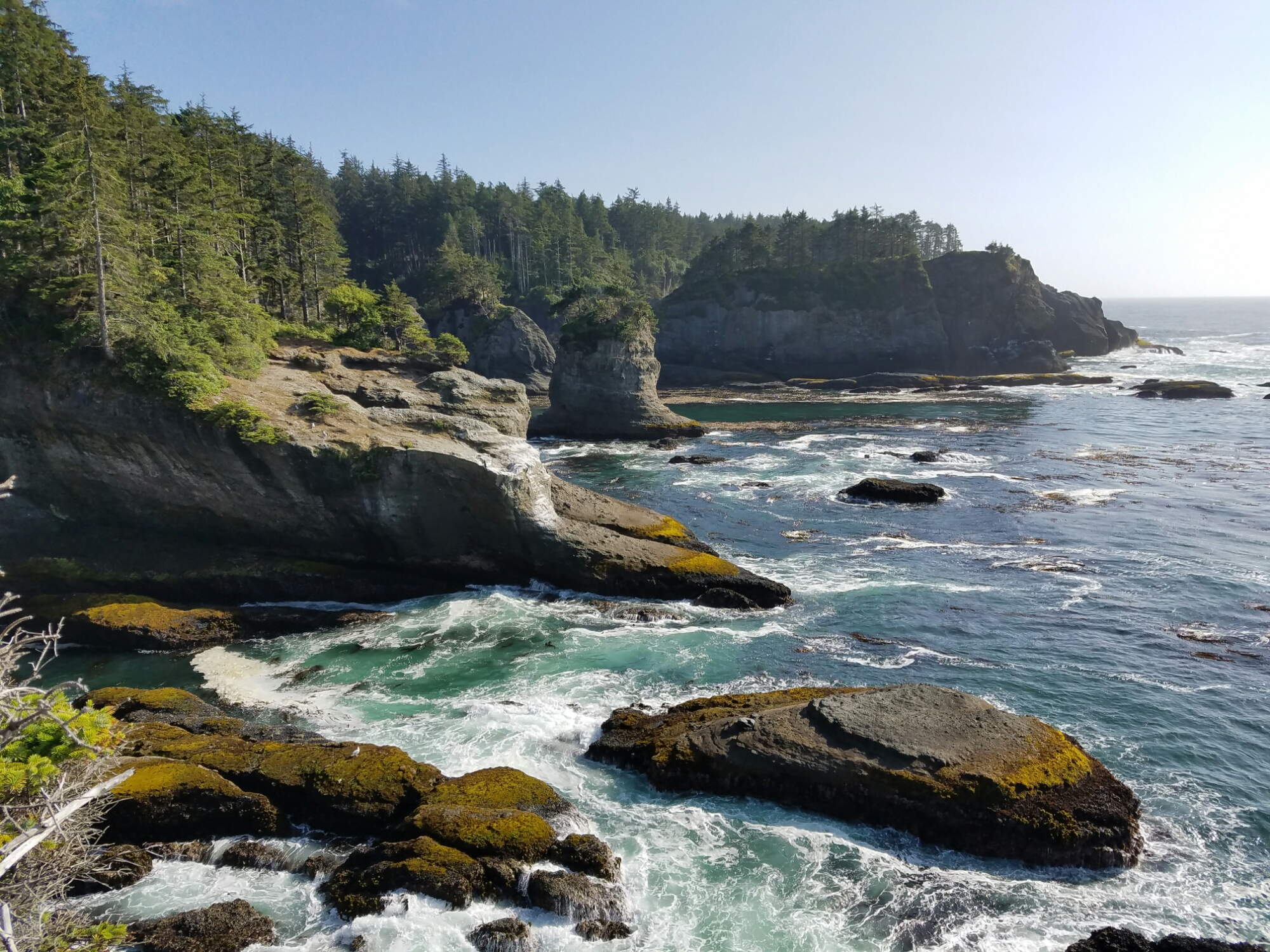
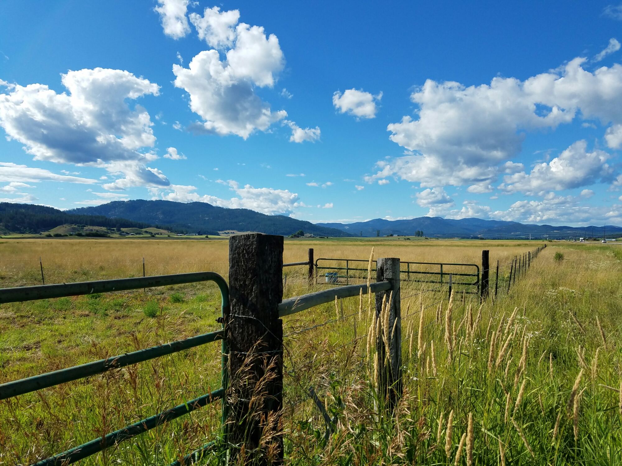
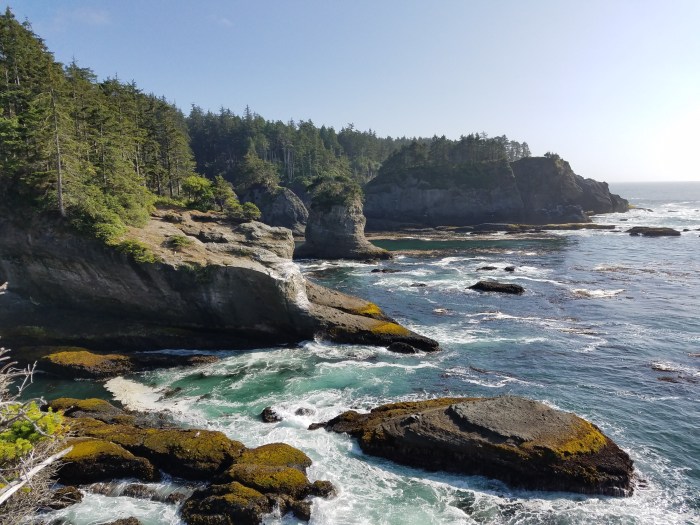
By many measures, Washington state has to be one of the most diverse states in the U.S. During our summer tour, we saw almost every type of land formation, body of water and climate imaginable. We started and ended our trip on a ferry navigating through the many islands dotting the Salish Sea. We drove through mountain passes in the north, south, east and west – usually with snow-capped peaks towering above us. We camped on lake shores, river banks and ocean beaches. We hiked through the arid hills of the Palouse, the dry desert of central Washington and the wet trails of the Olympic Rainforest. The chore of breaking camp was always exciting because we knew we were about to travel through an area that was radically different from the one in which we’d been staying.

Though statistically not the most ethnically diverse state in the union, Washington is made up of people from every background – from the Volga Germans of Ritzville to the Makah of Neah Bay. With our road trip falling during the major parties’ election year conventions, we passed by countless yard signs reminding us of the political extremes that exist in Washington state. If you want a sense of just how diverse this country is – on every level – I strongly encourage you to travel from one side of Washington to the other.

4. This land doesn’t belong to us.

doesn't belong

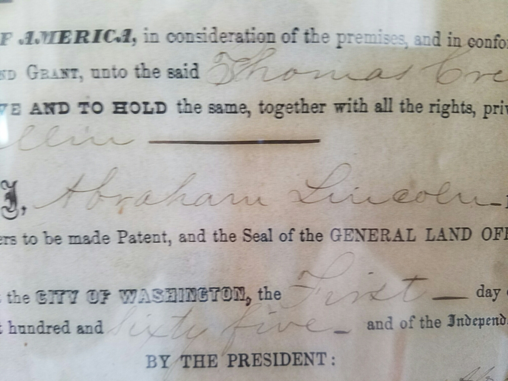
“ProjectWA” almost seemed like a misnomer by the end of the summer. Most of what we experienced during our trip reminded us that the vast majority of this region’s heritage dates back long before 1889, when Washington became the 42nd state. U.S. citizens are newcomers here, and we have a lot to learn from the people who occupied this land for thousands of years before David Thompson took his canoe down the Columbia River. For instance, before the creation of Lake Roosevelt that flooded the Kettle Falls, Native Americans figured out how to fish sustainably – allowing large numbers of salmon to spawn upriver before the first fish was plucked from the falls every year. The Makah practiced sustainable whaling for 1500 years, using every part of a whale for subsistence, before unsustainable whaling by other cultures placed whales on the endangered species list.

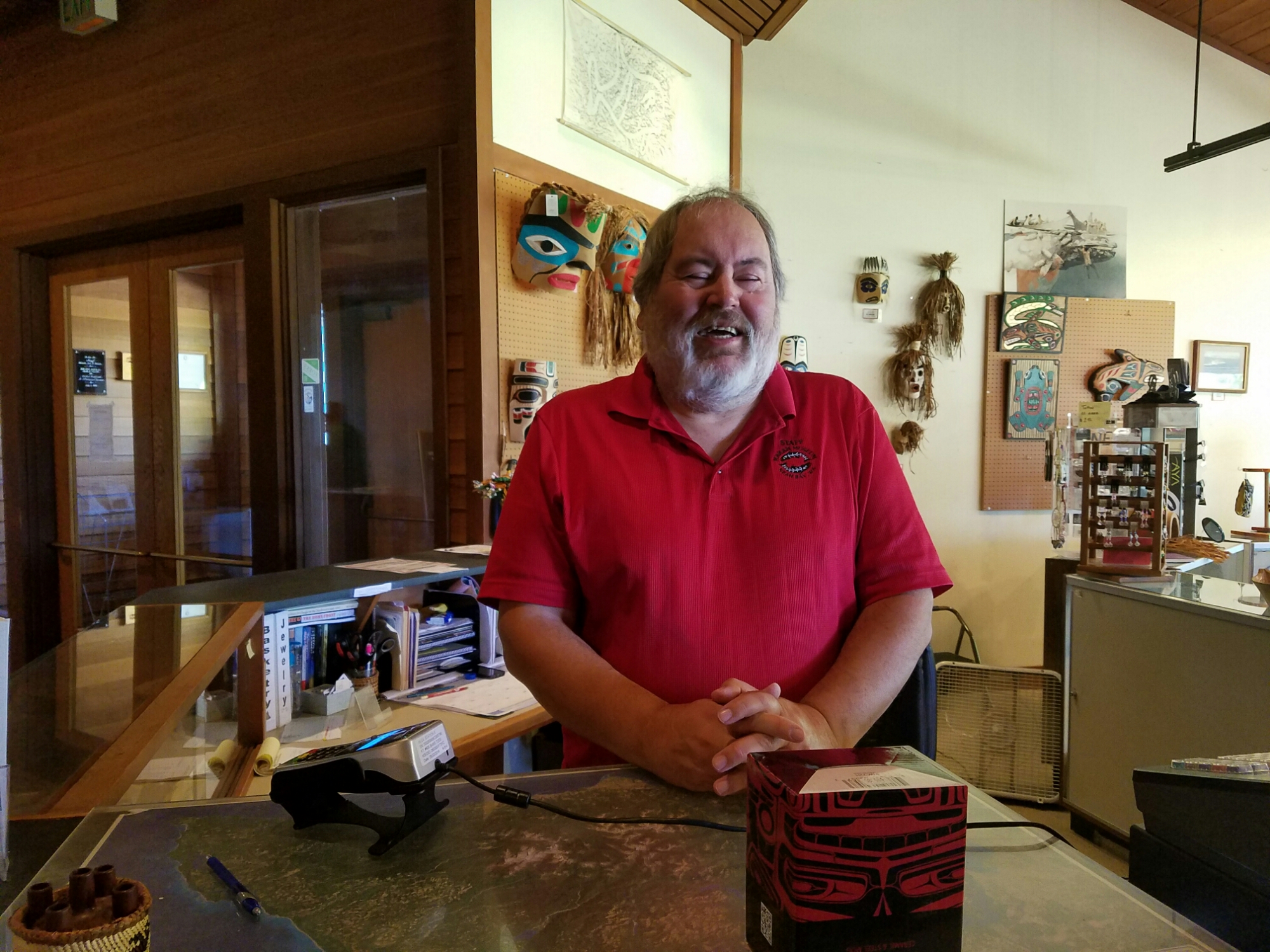
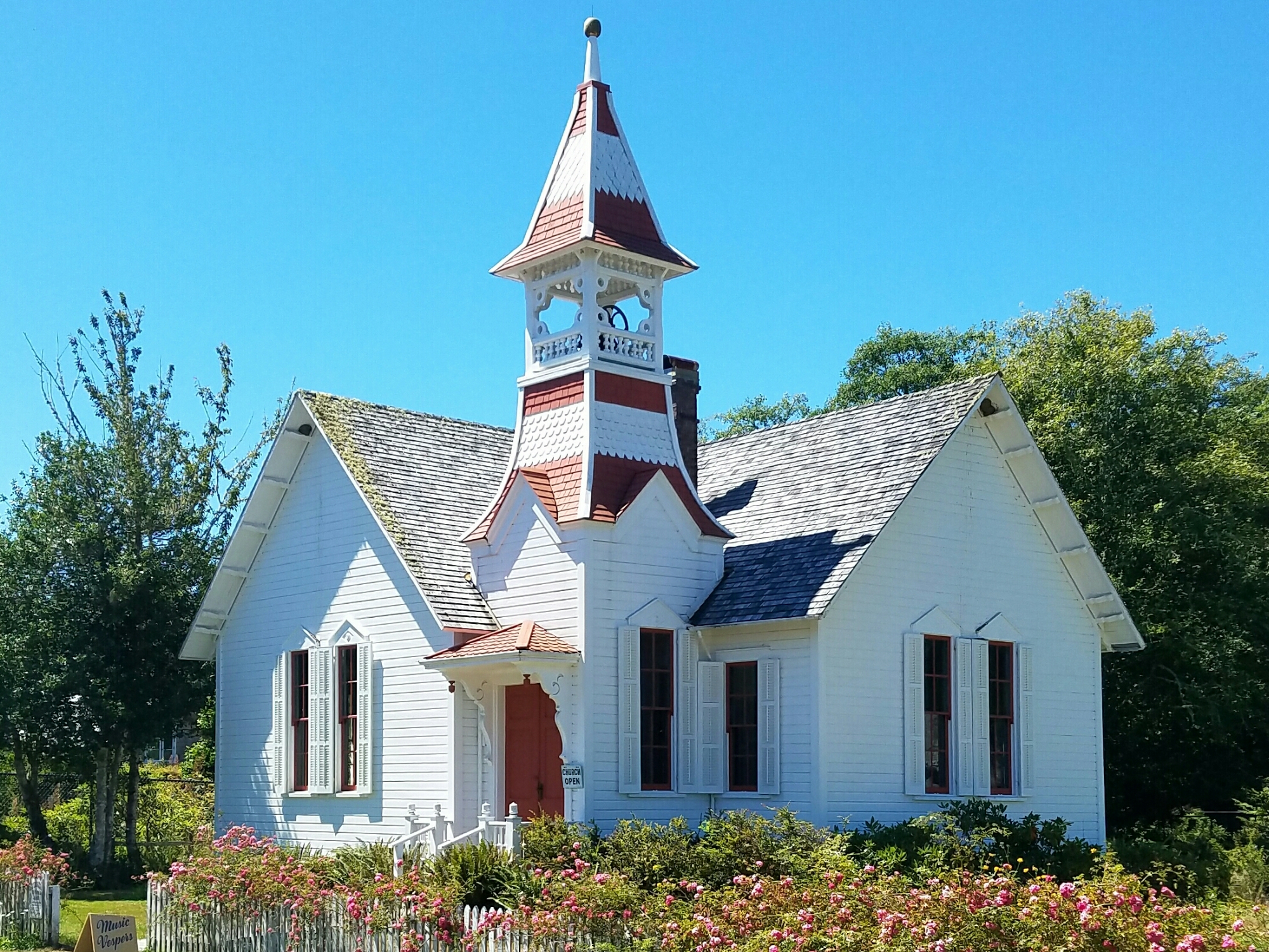
Yes, there is so much to learn and be proud of from the past 200 years. But no examination of Washington state is complete without an understanding of who inhabited this region before its “discovery” just a few hundred years ago. When you’re in Northeastern Washington, look up Joe Barreca, president of the The Heritage Network. And the next time you’re on the Olympic Peninsula, pay a visit to Kirk Wachendorf at the Makah Museum in Neah Bay. What you’ll learn from them is that this land doesn’t belong to us as much as we belong to the land.

5. We should invest in a heritage economy.

wp-image-1515473151jpg.jpg

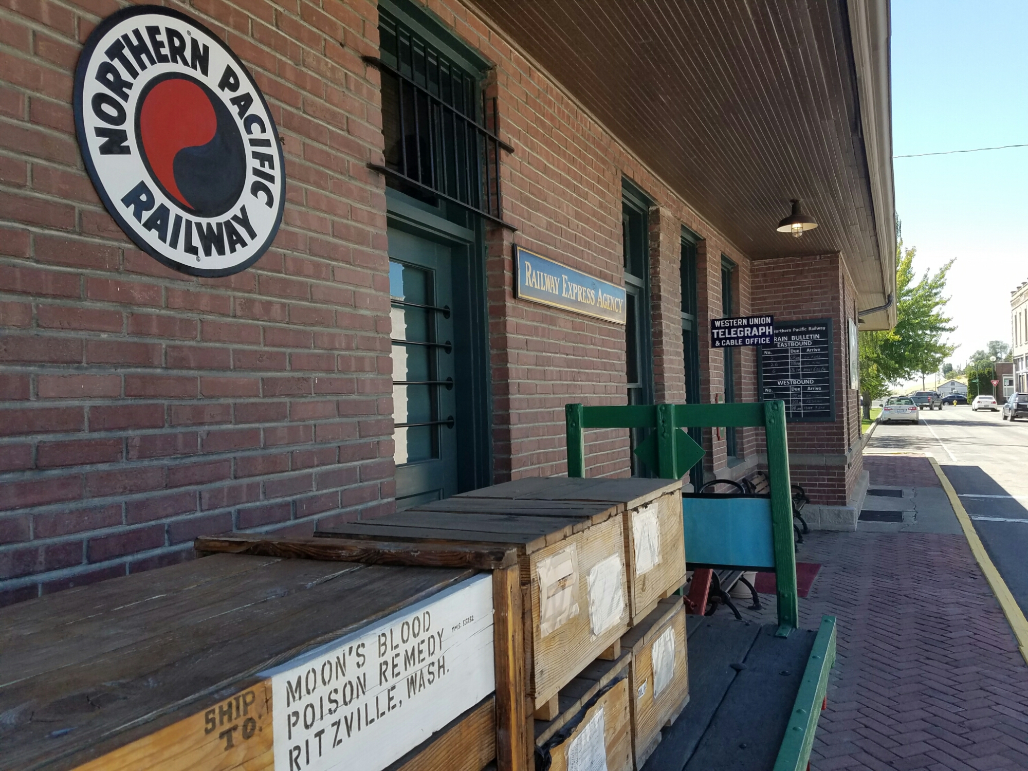
Washington state’s secondary highways are the Main Streets of so many small towns, and it seems like our ProjectWA RV drove through most of them this summer. Unless one stops and looks around, it’s easy to put all of these communities into the same category: towns that peaked sometime in the 20th century and have been in decline since losing a major industry – usually one based on a natural resource such as timber, mining, farming or fishing.

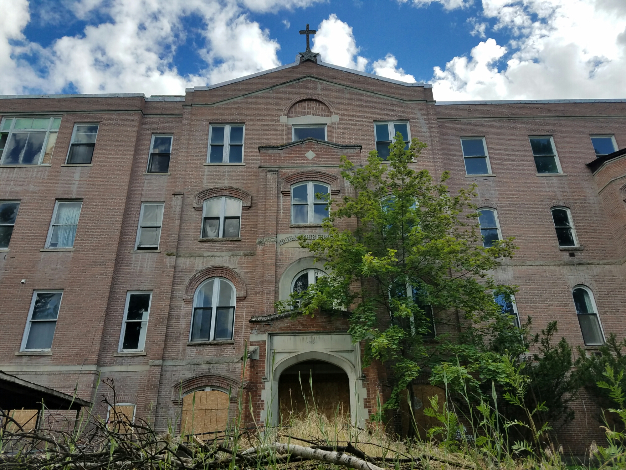
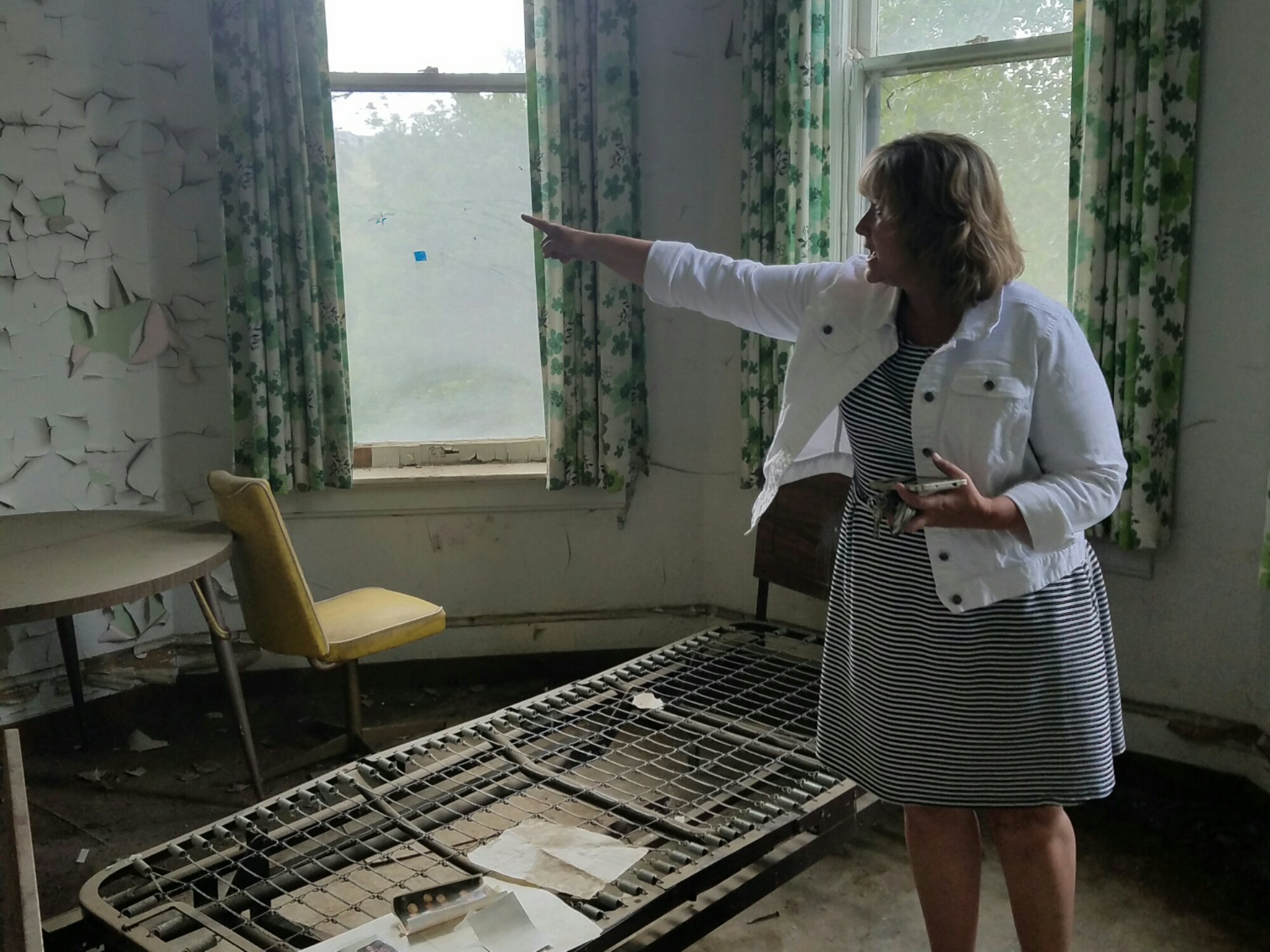
When we did stop to investigate, Team ProjectWA quickly discovered a gold mine just below the surface of these small communities: their unique heritage. Whether it’s the baptismal font installed without a drain, the insider trading that established a county, or the haunted hospital on the hill, the stories of these towns run deep. With a little creativity, like what Colfax has done with its ghost hunts, a new heritage-based economy can emerge to supplement or replace the industries that allowed these communities to thrive in years past.

Creating a heritage economy isn’t about building more museums. It requires engaging people in the community’s unique history in a way that makes them want to stick around and explore more. Doing so is of course easier said than done. Community leaders must find a new way of doing things and challenge old assumptions. In Colfax, Val Gregory turned her town’s greatest weakness, abandoned buildings, into a strength: revenue-generating ghost tours.

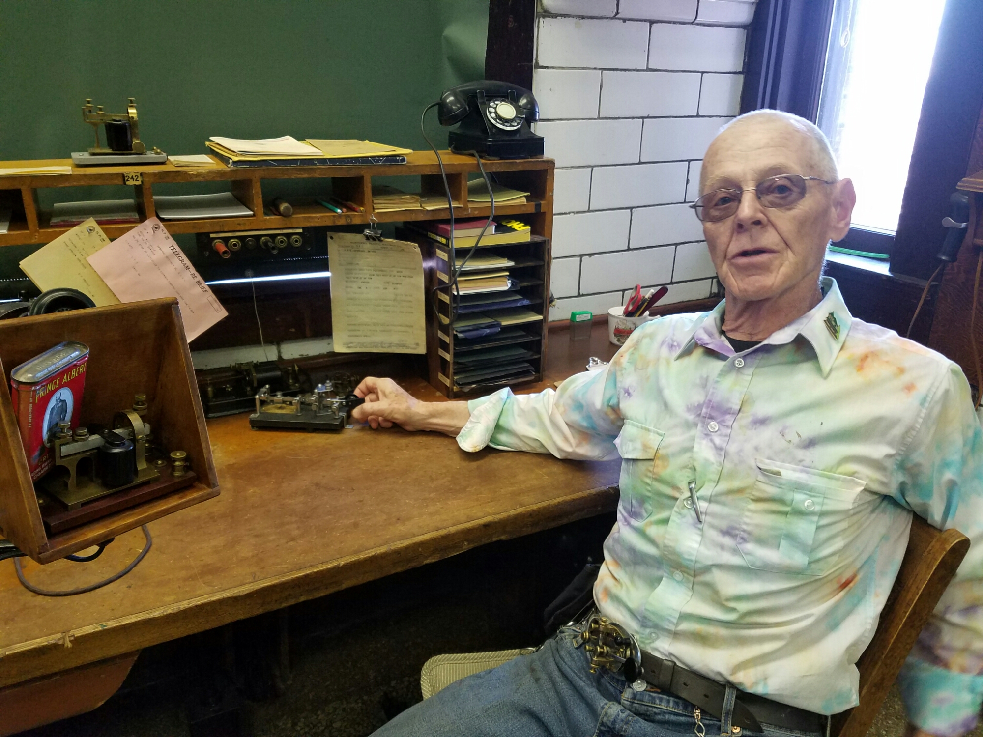
Given its presence in our daily lives, technology should play a role in a heritage economy. What a group of Lopez Island middle schoolers and I did with Washington State Insider is just one use of technology to showcase history and drive exploration. Spokane Historical, created by EWU students, is a great mobile app and website that tells the stories of Spokane and Eastern Washington. Lake Chelan is placing interactive kiosks around the state to grab travelers’ attention. And, we all saw how Pokémon Go got people exploring all kinds of places this summer.  Regardless of how it’s done, the key to maximizing the return on a community’s historical assets is to make its heritage relevant to a new generation.

Our ProjectWA summer will not be soon forgotten. After traveling more than 2000 miles around this state, my family received much more than a history lesson. We became deeply connected to our home and inspired to make “old” things new again. The “Evergreen State” moniker has taken on an entirely new meaning.

Team ProjectWA

It’s Complicated 

“It’s Complicated.”

This was how Interpretive Specialist, Kirk Wachendorf, ended most of his statements during our conversation at the Makah Museum in Neah Bay earlier this week.

Kirk Wachendorf, member of the Makah Nation

What’s complicated for Kirk is explaining the current state in which the Makah Tribe finds itself after two hundred years of intertwining the cultures of the native Makah and relative newcomer Americans. The Makah Nation makes up about 28,000 acres on the Olympic Peninsula in the northwesternmost corner of Washington state. Before the Treaty of Neah Bay, signed by the U.S. government and Makah Tribe in 1855, the traditional Makah homeland was as large as 700,000 acres.  That treaty represented the first of many agreements between the Makah and the U.S. that have massively impacted this Tribe’s way of life.

The Makah, more than any other Native American tribe, has relied on the sea for its survival. Traditionally, the Makah were known for whale and seal hunting and salmon fishing, which they practiced sustainably for thousands of years. That has all but come to an end as countless marine animals have become endangered and salmon populations have dwindled.

In 1974, to help address salmon habitat loss due to logging, pollution, dams and overharvesting, the U.S. federal court’s Boldt Decision helped reaffirm the Makah right to fish in their “usual and accustomed places and stations” while restricting the amount of salmon caught by non-natives.  The years following the decision were filled with conflict, as non-native fisherman resented their Native American counterparts for the impact this had on commercial and recreational fishing.

Fishing boats moored in Neah Bay

Yet, as Kirk says, “it’s complicated.” The Boldt Decision, intended to both protect salmon populations and the Makah way of life, ended up drastically affecting the economy around Neah Bay.

Kirk remembers when celebrities like Bob Hope and John Wayne would flock to Neah Bay by yacht to enjoy the area’s fishing and related offerings. It’s hard to imagine such a scene today. “There used to be ten different fishing resorts,” said Kirk when reminiscing about the peak of Neah Bay’s fishing industry. “Today, there’s one.”

According to Kirk, Neah Bay’s unemployment rate now ranges between 50 and 80 percent, depending on the season. Before he graduated from high school, it never reached higher than ten percent.

“The demographics have totally changed,” explained Kirk.  Before the decline of the area’s fishing industry, the population was pretty evenly distributed by age. Today, according to Kirk, the average age is 23. “The older generation has mostly moved away… [and] the younger people that stuck around are waiting for something to happen.”

What happened for Kirk was the discovery of the Makah Indian coastal village of Ozette in 1970 – a year after Kirk graduated from Neah Bay High School – when tidal erosion exposed a group of 500-year-old Ozette homes that had been perfectly preserved in an ancient mudslide. Led by a group of W.S.U. archaeologists, the now famous Ozette Dig 15 miles south of Neah Bay is perhaps the most significant archaeological find in North America. In 1973, Kirk helped establish the Makah Museum, which is the sole repository for the artifacts found at Ozette.

The Makah Museum in Neah Bay

The museum, where I spent the better part of a morning this week, does a great job of telling the story of the Makah – and by extension – the story of most Native Americans. Upon entering the exhibit area of the building, one is confronted by a poster laying out historical facts we all should know. For instance, in exchange for retaining their fishing and whaling rights, the Makah ceded 300,000 acres of tribal land to the United States. In the years that followed, government representatives – Indian agents, missionaries and school teachers – worked to assimilate the Makah through laws against potlatches, ceremonies and speaking the native Makah language.

After the Indian Treaties of the 1850s, in order to retain their tribal affiliation, individuals would have to prove to the U.S. government that they were at least one-quarter Makah. With only 2200 members of the Makah Tribe left, this has become increasingly hard to do. Kirk, who was born one-quarter Makah, decided to marry his second cousin so that his children would be recognized as members of the tribe. Because, by federal law, one can only be a member of one tribe, marrying individuals from other tribes doesn’t count towards one’s tribal affiliation.

These are among the “complicated” facts one learns at the Makah Museum. Anybody remotely interested in Washington state history should make the museum – and others like it around the state – a must stop. The story of the Makah provides important context for all the other stories of the past two hundred years since Lewis and Clark’s Corps of Discovery expedition.

Beyond its excellent museum, the Makah Reservation has a lot to offer anybody who visits. Cape Flattery, the northwesternmost point of the continental U.S., has some of the most beautiful scenery in the state, if not the country. The Makah maintain a raised wooden trail that winds through old growth forest on its way to the cliff that overlooks the Pacific – where Makah first saw “houses on the water people” approaching their land. The trails around Lake Ozette are just as picturesque. And the beaches are perfect for everything from sand dollar collecting to surfing.

Before I left the Makah Museum I asked Kirk what he thinks the prospects are for the Makah Nation now that its traditional way of life has been curtailed. He didn’t have many answers. The future, just like the past, he said, “is complicated.”

Cape Flattery, Makah land and the northwesternmost point of the continental U.S.

No Drain 

The Oysterville Baptist Church was built in 1892 so that the town’s founder, R.H. Espy, would no longer have to host services for the town in his living room. Baptisms, though, continued to take place in nearby Willapa Bay, because the church was built without a baptismal font. That was about to change. A font had been installed under the church’s dais, and Oysterville parishioners were busy getting ready for their town’s first indoor baptism. Hundreds of gallons of water were carried, bucket-by-bucket, from the town’s well to the church – a task that took the better part of the morning. The child was baptized, refreshments were served in the parsonage, and the Baptist Church had a new official member. All was right in Oysterville. That is, until the cleanup crew realized one fatal flaw in their baptismal font: it had no drain.  And then, the same folks who’d spent all morning filling the font spent the rest of day emptying it. Bucket by bucket. This was the first and last baptism ever to be held in the Oysterville Church baptismal font.

The Historic Oysterville Church

Sydney Stevens, great grandchild of R.H. Espy and co-chair of the Oysterville Restoration Foundation, told me this story as we stood in front of the town’s historic church this week. As I reflect on my visit with Sydney, I realize that this isn’t just a humorous story about an ill-fated baptismal font. In many ways, this is the story of Oysterville itself.

For those not familiar with this small town, Oysterville used to be the County Seat of Pacific County, Washington state’s southwestern-most county that serves as the gateway to the Columbia River from the Pacific Ocean. The town is the northern-most town on the bay side of the Long Beach Peninsula, facing Willapa Bay to the east. Oysterville’s most reported claim to fame is the fact that its hold on the county seat was wrested away on February 3, 1893, when residents from across the bay stole the county records and returned to South Bend, which was to become the new county seat.

Oysterville’s future wasn’t determined by the midnight raid on its records house. Its fate was sealed by geography. As railroads started to crisscross the Northwest in second half of the 19th century, the location of depots had a huge impact on whether a town thrived. One look at a map of the Long Beach Peninsula is all you need to decide it’s probably not worth it to lay tracks all the way to the tip. The furthest north the Ilwaco Railway ever reached was Nahcotta, four miles south of Oysterville.

Despite its proximity to Willapa Bay, Oysterville was just as difficult to reach by water as it was by land. The bay’s original name was Shoalwater Bay, indicating to sailors they should steer clear unless they wanted to run aground. Half the bay’s water leaves it at low tide. Needing to wait for high tide, it was difficult for ships to navigate to the shores of Oysterville.


One of the few road signs in Oysterville


Due to its geographic challenges, even its one-time booming oyster industry wasn’t enough to attract enough people to turn Oysterville into the size of town that R.H. Espy probably once dreamed it could be. I imagine R.H. having a “no drain” moment as he came to grips with the fact that his town was out of reach for the main modes of transportation of his day.

With 14 residents (30 if you count the part-timers), Oysterville is better described as a neighborhood that has some really interesting history. It’s primary industry? Storytelling. It’s Chief Storytelling Officer? Sydney Stevens.

When I asked Andi Day, Executive Director of the Long Beach Peninsula Visitors Bureau, whom I should contact to get a good local history lesson, she immediately pointed me to Sydney. She lives with her husband, Nyel, in the house her great grandfather bought to use as a parsonage for the Oysterville Church. Hanging on the wall of the house is the deed for the land on which the house sits, which was signed by Abraham Lincoln. Since retiring as a teacher, Sydney has become an incredibly prolific author about all things Oysterville and the Long Beach Peninsula. Beyond her numerous books on the area’s history, Sydney posts every single day on her blog, sydneyofoysterville.


In 1865, Abraham Lincoln signed the deed granting land on which the old Espy House sits

The stories started from the moment I sat down on Sydney’s couch. She’d read my post on Colfax’s haunted hospital, which sparked her first tale about the wife of Oysterville’s first preacher, who mysteriously drowned in Willapa Bay – most likely due to foul play by the preacher, Josiah Crouch. Sydney, who doesn’t really believe in ghosts, is pretty sure Mrs. Crouch maintains some kind of presence in her house. I was so interested in the story, I bought Sydney’s Ghost Stories of the Long Beach Peninsula book on the spot. After reading it, I definitely plan to buy more.

Sales of Sydney’s books are probably the single biggest contributor to Oysterville’s economy. That, and sales of burial plots in the cemetery, which Sydney also happens to manage. Demand for space has slowed as the town’s population has dwindled. “We still have lots of room,” joked Sydney, as she told me about how the cemetery was doubled in size (from one acre to two) in the 1970s, before cremation gained in popularity.


Sydney Stevens, telling one of her many stories inside the Oysterville Baptist Church


As we talked outside the church, over walked Tucker Wachsmuth, one of Oysterville’s 14 residents, and his cousin Cory Schreiber, from Portland. Both are descendants of another one of Oysterville’s early inhabitants. Tucker’s wife, Carol, in her early sixties, is the youngest resident of the town.

Realizing that the average age in Oysterville is probably north of seventy, I asked Sydney what she thinks will happen to the town in the future. “Well, my only son just turned 60; he doesn’t have children, and I don’t expect that to change,” she said. Though it’s clear to me that Sydney, at 80, has many more good years in front of her, it’s not entirely clear what will happen to this little community with such a rich history once she “shuffles on.” Sydney has done an amazing job of documenting the area’s stories. Somebody needs to step up to continue the good work she’s done.

When I asked Tucker Wachsmuth what he’d like to see happen to Oysterville, he said: “I’d like to see more young families move here.” I agree that’s probably the best way to ensure Oysterville’s population doesn’t continue to shrink. If that’s what the town agrees should happen, it might be time to install a drain in the baptismal font.


Cory Schreiber, Sydney Stevens and Tucker Wachsmuth, all relatives of Oysterville’s original residents


Embrace the Ghost 

As we walked up the dark stairway that creaked with each step, Val said, “This is where the nuns used to live.” We got to the top of the stairs and entered a room that was pitch black. The room’s only window had been boarded up. Our only source of light was the flashlight app on Val’s phone, which was illuminating 100-year-old paintings on the wall that depicted scenes from the Bible. We turned the corner, and Val, who was standing behind me, said: “And this was Mother Joseph’s apartment; not many people were allowed in here.” As light from Val’s phone flickered, I saw what looked like a refuge for meth users: a stained mattress on the floor, faded 1970s posters on the wall, detritus scattered around the room. I was trying to keep my cool, but the whole time I was thinking to myself, “I’ve known this woman for all of 20 minutes, and now she’s taken me to this dark corner of an abandoned building… Nobody even knows I’m here.”

I obviously lived to tell about this experience, so Val isn’t an ax murderer who’d lured me into a trap. No, Val Gregory is the very friendly, funny and creative Executive Director of the Chamber of Commerce for Colfax, WA. She agreed to meet with me when Team ProjectWA was touring Washington’s Palouse region this week. Val also manages the Colfax Historic Preservation Commission, so the Chamber and Historical Society are co-located in the Perkins House, the oldest home in Whitman County.

Within a few minutes of parking the ProjectWA RV in front of the Perkins House, Val suggested we take a tour of St. Ignatius Hospital, which sits on the hill above downtown Colfax.  The building, which was a care facility for developmentally disabled children and adults until it was closed in 2003, has remained abandoned ever since – gradually becoming known as the “haunted hospital” on the hill. St. Ignatius, built in 1893 by the Sisters of Providence, was Whitman County’s first and only hospital until 1968. It was designed by Mother Joseph herself, who lived there for years with other nuns who ran the place. As I learned over the next hour, St. Ignatius had some… quirks.

Val drove me up to the hospital in her pickup truck. The exterior of the building was right out of an old Scooby Doo cartoon. “Watch out, there’s a colony of bats that lives in the chimney,” Val said when she flung open the door and invited me in. I stepped into the hallway, which was extremely cold considering outside it was pushing 90 degrees.

“I have a present for you,” said Val as she tossed me a light blue hospital gown with “St. Ignatius Hospital” embroidered on it. “We found several of these in the basement morgue last week.”

“Of course the hospital has a morgue in its basement,” I thought as I accepted my Colfax souvenir.

Val then proceeded to give me a tour of every floor of the five-story brick building. Plaster peeled from the walls, shards of glass from broken windows lay scattered on the floors, and old wheelchairs and hospital bed frames were randomly placed throughout. Every room had a story.

“This is the infectious diseases floor,” explained Val, who went on to tell me about the patient who’d been admitted in the 1950s for maggots growing between her toes. Then there was the one about the three-year-old who’d died here after swallowing chrome cleaner.

When we got to the room where babies were delivered, it became clear that Val was born to give this tour – literally. That’s when Val told me she was delivered right here at St. Ignatius Hospital in 1966. Then she cheerfully asked, “want to check out the nuns’ old apartment?”

Val Gregory showing me the room where she was born

It was at that point that I began wondering if Val was out to get me, or if she was a genius. After surviving the tour, I decided: definitely the latter.

Val’s been in her position for barely a year. After three days on the job, she asked her bosses if they knew who owned the abandoned hospital on the hill, and how could she get the keys. Val wanted to open it up for tours.

“Val, that’s crazy; nobody wants to go in there,” they told her. On the contrary, Val said, “People love scary stuff.”

That was in October 2015. Since then, more than 2500 people have toured the hospital – paying $45 for nighttime “ghost hunts” and $20 for day tours.  Organizations from all over the U.S. have sent in their paranormal teams to study St. Ignatius. In August, the Discovery Channel plans to spend a week in the building on “paranormal lockdown.” Yes, Val is definitely a genius.

If you visit any small town like Colfax these days, “ghost town” is a dirty word. Industries mature and disappear. Big box and online retailers cause Main Street retailers to close down. Younger generations move to the big city. Val Gregory has realized that Colfax’s greatest weakness – abandoned buildings – is also its greatest strength. She’s embraced the ghost. The tagline for her shop local campaign? “Ghost Towns Happen When You Don’t Shop Local.”  Val has moved beyond haunted hospital tours. She’s secured the keys of several of Colfax’s empty buildings downtown – from the old Mason Lodge to the doctor’s office that’s been vacant since the 1950s. 

The Perkins House, oldest home in Whitman County, HQ for Colfax’s Chamber of Commerce

According to Val, Colfax’s mayor, Todd Vanek, recently said, “I never thought we’d be a ghost town, but I’m glad we are now.” With the revenue that Val has brought in with the ghost tours, I’m sure the mayor is much more accepting of empty storefronts on Main Street.

As I’ve visited dozens of small communities around the state, it’s become clear that historic towns like Colfax aren’t necessarily destined to be actual ghost towns. Their historical assets – from haunted hospitals to train depots – can be mined and harvested just like the hills above Colville or the fields of the Palouse. All it takes is a bit of creativity, and maybe a somewhat twisted sense of humor. Thankfully, Val Gregory has both.

The Rise and Falls of the Columbia  

“The Columbia is the most powerful river in the world.” This is what Joe Barreca, president of The Heritage Network, said to me as we walked the bluff above the massive river below, where Fort Colvile used to stand. Yes, the Columbia is the most hydrologically powerful river in the world due to its volume and the elevation; but Joe wasn’t just referring to the river’s powerful water flow. The Columbia River has altered the course of history – for the inhabitants of Washington State and the world.

The Columbia River

Soon after David Thompson, a fur trader from the North West Company, arrived at Kettle Falls on the Columbia River in 1811, he discovered a way to navigate all the way to the river’s mouth at Astoria. This discovery was more than just a faster way to move furs to the coast; it was the final link in a global trade distribution route. Furs that reached the Pacific were shipped to China, where they were traded for china that was then shipped to Europe and traded for iron, which would then make its way back to America, where the cycle would start all over again. The Columbia River sparked one of the first global trade deals, and with it, rising fortunes of the northeast corner of Washington – today’s Stevens, Ferry and Pend Oreille Counties.

The area around Kettle Falls was rich long before the arrival of David Thompson. As I started my tour of the Tri County area with Joe Barreca, he pointed out that Native Americans had thrived in this region for millennia. “While the Roman Empire rose, fell and rose again, these guys lived sustainably for 10,000 years.” During the summer salmon runs, they’d pull as many as 1700 50-pound salmon out of the river every day. The “salmon chief” would allow a great number of salmon to go up over the falls before he would allow fishing to begin to sustain the fishery.

Joe Barrera explaining ancient Native American fishing techniques at Kettle Falls

In the century after Thompson’s arrival, new settlers arrived and industries emerged. Out of the fertile land along the river sprouted more than 100 different varieties of apples and other fruit. In 1852, Joseph Morel, a Hudson Bay employee who settled along the Colville River, discovered gold at Waneta – leading to a mass migration of gold miners up from California. Timber and minerals from the surrounding hills were transported to other parts of the world – via the Columbia, and later the Corbin Railroad. Though at the expense of the area’s original people, the new inhabitants of northeastern Washington prospered in the late 19th and early 20th centuries.

While I was getting this history lesson from Joe, I couldn’t help wondering about the disparity between this region’s past prosperity and its current economic status. Ferry, Stevens and Pend Oreille Counties regularly rank among the most economically distressed counties in Washington State. What happened?

“They destroyed what would have been the bread basket of the Northwest,” said Joe, looking out over Lake Roosevelt, which was created when the Columbia River was backed up more than 100 miles with the construction of the Grand Coulee Dam in the late 1930s. More than 30 river towns were flooded, and thousands of people were relocated by the creation of the reservoir. The dam also blocked the migration of salmon and other fish upstream to spawn. The flooding of northeastern Washington’s Columbia River valleys also explains why Wenatchee, and not Kettle Falls, is known as the “Apple Capital of the World.”

“We were sacrificed for the power of the rest of the region,” continued Joe, as he and I stood at the Sharpening Stone, where Native American fisherman used to sharpen their salmon spears.


The Sharpening Stone above the Columbia River

I might be worried about Tri County prospects if I wasn’t aware of current economic trends in Washington State. With agritourism and outdoor recreation on the rise, the fortunes of the region are less and less tied to the industries responsible for its economic boom a century ago. Jon Snyder from the Governor’s Policy Office for Outdoor Recreation & Economic Development recently pointed out to me that outdoor recreation contributes to $2.6 billion in economic activity in Washington State – rivaling aerospace and software. As railroad tracks are converted to bike trails, kayaks replace logs on the Columbia and “farm-to-table” becomes part of our lexicon, I expect natural wonderlands like the northeast corner of Washington to thrive.

Last month, Erich Ebel from the Washington State Historical Society told me that, “people are gravitating toward heritage tourism.” As they do, towns like Kettle Falls and Colville need to find ways to surface the unexpected treasures locked within their museums. You’ll find more than just catalogued artifacts within their walls.

Before we started our drive from Colville to Kettle Falls, Joe took me through the Stevens County Historical Society’s Museum. They have an entire room dedicated to one of the most interesting 20th century artists I’ve seen, Leno Prestini. This Clayton, Washington artist’s work defies categorization, but some describe it as surreal and eccentric. No matter how you describe it, Prestini’s art is not to be missed if you’re traveling through Stevens County. I’d even say that it’s a reason to make Colville a destination.


One of many Prestini paintings on display at Stevens County Historical Society’s Museum

My afternoon with Joe Barreca was one not to be forgotten. It was a lesson in history, sociology, economics, cartography and art. It’s fitting that Shelly Stevens from the Tri County Economic Development District calls Joe a “walking encyclopedia.” I encourage you to check out the Historical Society’s Museum. If you’re lucky, you’ll run into Joe when you do. Ask him about the Columbia River.


The river valley outside of Colville, WA

Founding Trains 

Any student of Washington State history will learn that the fate of many towns was determined by trains. Ritzville, about 60 miles southwest of Spokane, is no exception. The train that established Ritzville, however, wasn’t one of the locomotive-driven variety. Ritzville owes its beginnings to a wagon train.

In the 1870s, the Northern Pacific Railway had not yet reached the Ritzville area. The settlement was made up of about 50 cattlemen. In 1882, that population quadrupled overnight when a wagon train of 17 Volga German families decided to stop in Ritzville. They had started in Russia.

Volga Germans are ethnic Germans who immigrated to land along the River Volga in Russia. They were among a group of Europeans in the mid-19th century who were invited by Catherine the Great to colonize Russian lands. The Volga Germans were allowed to maintain their language, religion and farming culture. When they started to be drafted into the Russian army, they packed their bags and headed to the United States, many making their way to the western frontier – places ideal for farming, like Ritzville.

With an infusion of Volga German famers Ritzville began its reliance on farming in earnest. The town was officially founded, wagon trains were replaced by Northern Pacific Railway trains and a depot for shipping out wheat was constructed. By 1901, Ritzville became the largest exporter of wheat in the world – a fact I learned, among other things, on my visit to this small eastern Washington town last week.

“Most people assume Ritzville is the gas station and restaurant you see from I-90,” said Ann Olson, a descendent of one of the 17 wagon train families and manager of Ritzville’s two museums. I must admit, like most people, my experience in Ritzville has been limited to refueling while driving from Spokane to Seattle. Ann gave me a tour of the town that opened my eyes to the critical contribution Ritzville – and so many towns like it – have made to the state’s heritage.

Among the most interesting places I saw on my tour was the Railroad Depot Museum. If railways were the lifeblood of towns on the frontier, depots were the heart. Ritzville’s railroad depot was more than just a place to load and unload traincars of wheat. It’s where people voted, bought their newspapers, sent telegrams and went to church. The railroad depot was the community center. It was apparently also the town’s clock. To this day, the noon whistle blows loud enough for the entire town of Ritzville to hear.

Given depots’ role as communications hubs the most important position at these places was the Agent-Morse Telegrapher. This person was responsible for keeping the depot’s telegraph office open 24 hours a day, seven days a week. The agent not only had to be competent in operation of the telegraph system; he or she also had non-railroad duties, such as issuing marriage licenses and serving as notary public.

As Ann was showing me around the Ritzville Railroad Depot Museum, in walked – as if on cue – one of her octogenarian volunteers, L.R. Keith. He’s a trained telegrapher, making him perfect for showing museum guests the depot’s main exhibit: a working telegraph office.  L.R. takes his trade very seriously. He proudly wears a telegraph key belt buckle.

“I’m going to be buried with this belt buckle,” said L.R. as he slid into the telegrapher’s chair and quickly started to input code into the telegraph key sitting on the desk.

“How many words per minute can you type?” I naively asked.

“You’re asking the wrong question,” L.R. sternly replied. He then recited the dozens of different types of codes a telegrapher must learn, each corresponding to a different industry. L.R. used to work for Western Union. Like many others before him, his last stop as he moved west was Ritzville.

L.R. Keith, professional telegrapher and Railroad Depot Museum volunteer

After our encounter with L.R., Ann showed me around the rest of the museum, which has 150 years of Ritzville’s history on display. Newspapers. Sports team uniforms. A horse driven hearse. The old dentist’s chair. I was amazed by how comprehensive the place was.

“Every time granny dies, somebody brings us stuff,” said Ann, as she showed me 100-year old wedding dresses and fur coats, each of which comes with a photo of its former owner.

Ann Olson, manager of Ritzville’s two museums and descendent of early Volga German settlers

After a few hours with Ann, I have a much deeper appreciation for – and understanding of – the small towns (and their trains) that served as the foundation for Washington State. If you find yourself driving through Ritzville on I-90, I strongly encourage you to investigate further than a few hundred feet off the interstate. The Ritzville Railroad Depot Museum is a must-see.

Ann and I said goodbye as she realized she needed to get to a 12:00 meeting. How did she know what time it was? The noon whistle blew.

Ritzville’s Railroad Depot Museum

Buying Chelan County

In most places in Washington State, where a town developed was decided by the people who first inhabited the area or by the European settlers and American pioneers who showed up later.  Seattle owes its map to the Dennys and Mercers. Spokane (originally Spokane Falls) grew up along the Spokane River because early pioneer James Glover saw the falls as a great place for a sawmill. Most towns have a similar story: somebody shows up and says, “let’s settle here” – usually due to proximity to a natural resource like a river, bay, forest or farmland.

This week I learned that early development of Chelan County – and the placement of its county seat, Wenatchee – was decided by a guy who never lived there. The great folks at the Chelan History Museum introduced me to local historian, Rod Molzahn, who told about the decisions that drove early development and governance of the region.

In the late 1800s, railroads were rapidly making their way west – the most significant of which was the Great Northern Railway. Its owner, J.J. Hill, was friends with a Seattle attorney and judge by the name of Thomas Burke (as in the Burke-Gillman Trail in Seattle).  Burke’s good friend, Hill, fed him some very valuable inside information: the route his railroad would take through central Washington.

image

At the time, the town of Wenatchee had already started to take shape. It wasn’t where current downtown Wenatchee is; instead, it was up on the flat. According to Rod, “it had all the things a town needs to thrive – a meat market, hotel and a saloon.”

Burke knew the railroad would cut through the land closer to the Columbia River, well below the already established town. So, like any good insider trader, he quietly bought up 640 acres – at a very low price – along the river. Burke’s Wenatchee Development Company started a campaign to get people to move their businesses from “old town” to “new town.” He hired a couple from Ellensburg to start a newspaper in Wenatchee and act as his propaganda arm. He even sweetened the deal for businesses by offering to move their buildings closer to the river. Eventually, Burke’s scheme started to work. Businesses began to move, people learned about the railroad’s plans, and the value of Burke’s land by the river started to skyrocket.

image

Judge Thomas Burke by cartoonist Edwin F. Brotz

As Wenatchee and surrounding towns such as Cashmere, Chelan, and Stehekin started to thrive, a bill was passed in the state legislature to create Chelan County by carving off pieces of existing Kittitas and Okanogan Counties. This was fought aggressively by Okanogan County, which finally acquiesced in exchange for $77,000 in damages paid to them by the newly formed Chelan County.

The formation of a county required the appointment of county commissioners, the establishment of a county seat and the building of a courthouse. A compromise was struck between the geographically dispersed towns of Cashmere, Chelan and Wenatchee: the state legislature appointed three commissioners – one from each town.

With county commissioner representation decided, the towns couldn’t agree on the placement of the county seat. Chelan argued its nearby hydropower made it a good choice. Wenatchee, of course, had the railroad. Nobody had money to build a courthouse, though. After all, they had a $77,000 debt to pay to Okanogan County.

Guess who had a solution? Good ‘ol Judge Burke just happened to own a 3-story hotel in “new town” Wenatchee that he was willing to deed to the City of Wenatchee – for one dollar – provided that the County Commissioners name Wenatchee as the County Seat. The County Commissioners accepted the offer and to quiet the objections from the Chelan people ,the commissioners appointed Chelan area men to be the county’s first officers, including Sheriff Frank Keller, a rancher from Stehekin – a  tiny town accessible only by boat at the north end of Lake Chelan. “That was a great recipe for rapid response,” joked Rod, as he continued the story.

Because the county commissioners had to travel long distances to get to the county seat, Burke gave them each a room on the third floor  of his hotel – rent free. That’s how Wenatchee became the county seat for Chelan County. Coincidentally, that’s also how Judge Burke’s land increased in value.

image

So far on the ProjectWA road show, I’ve been fortunate to meet with several town leaders who have provided some colorful stories about their respective communities’ history. Early on, natural resources such as rivers, farmland or forests usually determined where a town grew. Later – as Judge Burke demonstrated – the railroad started to play that role.  In the information age, I think the next major economic factor for communities might be interesting stories. If so, Chelan County is going to do pretty well.

If you’re interested in some of those stories, stop by the Chelan Museum – they have quite a few. While you’re there, collect your points for visiting in the Washington State Insider app.

image

Left to right: Chelan Museum Board Member, Linda Martinson; Board Member, Roberta “Peach” Simonds; Museum Manager, Ron McGaughey; Board Member, Mary Sherer

The Enloe Dam Challenge

“Let’s just leave the car here and walk down,” Kristine and I said in unison as our little Ford Fiesta bottomed out on the steep, rocky road. We were intent on getting to the abandoned dam and waterfall below, but we were also intent on getting to Republic that evening in one piece. So we walked, well, scampered down to the river.

image

I’d been wanting to check out Enloe Dam ever since Ava gave a presentation on this endangered property back in February. When I found out this was named one of the 2016 Most Endangered Historic Properties by the Washington Trust for Historic Preservation, I insisted that we add it to our summer road trip itinerary. After hiking down to see it, I’m glad I did.

Henry and Ruby beat Kristine and me to the bottom. As I approached the river, I saw Ruby scaling the chain link fence at the river’s edge. I heard myself scream, “Ruby, haven’t you ever seen the Niagara Falls scene in Superman II!”

image

The Similkameen River falls are stunning. The mist rising up from the rushing water was very welcome, given it had turned into a warm day. We hiked down river to the point right across from the powerhouse. The building is in pretty bad shape, but I found myself imagining what could go on there if somebody restored it. Given its perch on the river and view of the falls upstream, it’d make a pretty spectacular restaurant. It would have been a great place to work 100 years ago, before Bonneville Power made the dam unnecessary.

image

After snapping some photos to document our accomplishment, we began the long walk back up the hill. The Fiesta made it out, but I’d recommend 4-wheel-drive to anybody planning on checking out Enloe Dam.

image

The Birthplace of Smokejumping

Six weeks ago, Andrew Thibodeau stood at a doorway. He slapped both sides of the door frame and then grabbed a pole to his right. A guy crouching behind him yelled “Get ready!” A moment later, that same guy slapped the back of Andrew’s leg. That was his signal to jump through the door. He was 1500 feet above a forest.

“I was doing fine until I grabbed that pole,” said Andrew, telling the story of his first parachute jump during a 6-week training course at North Cascades Smokejumper Base just outside of Twisp, Washington. Today, the ProjectWA team was lucky enough to get a history lesson and tour from Andrew on his first official day as a rookie smokejumper. After a rigorous training, he joins an elite group of 25 other parachuting firefighters stationed at an airfield situated in the Cascade foothills.

image

A CASA C-212 Aviocar sits ready to fly within 5 minutes of the alarm.

The Methow Valley became the birthplace of smokejumping in 1939, when fire guards, Francis Lufkin and George Honey, made 58 experimental parachute jumps to determine under what conditions firefighters could safely land in inaccessible mountainous areas to fight wildfires. Lufkin, who had spent several years dropping supplies by parachute into wilderness fire areas, said, “If we can deliver boxes via parachute, why can’t we also deliver people?” Today, smokejumping is the most cost-effective wildfire fighting method employed in the U.S. More than 400 smokejumpers are stationed at nine main bases and dozens of satellite bases in the western U.S.

image

Francis Lufkin, ready for his first experimental jump in 1939.

The critical role smokejumpers play in fighting wildfires has received more attention in recent years, as forest fires have increased in frequency and intensity. The 2015 Okanogan Complex fire was the largest in Washington State history.

Most people don’t realize the other critical contribution smokejumping has made to history. Until 1939, people didn’t voluntarily jump out of airplanes. Parachutes were for in-air emergencies, usually at high altitudes. Francis Lufkin’s new firefighting method demonstrated the feasibility of parachuting from low altitudes, with extreme precision, into a hostile environment.

In 1940, U.S. Army Major General, William C. Lee, visited the North Cascades Smokejumper Base to better understand how this new skill could be used for military purposes. Later that year, Lee became the first commander of a new parachute school at Georgia’s Fort Benning, which became the U.S. Airborne Command. Paratrooping was born. Four years later, 13,000 American paratroopers made night drops during D-Day, which turned the tide of World War II.

After taking Andrew’s tour, I understand the similarities between preparing for war and training to be a smokejumper. As if parachuting and firefighting aren’t hard enough, smokejumpers must also be expert rappellers and tree climbers. Though landing in meadows is the goal, sometimes they land in trees; so smokejumpers have to be in great physical shape to first get themselves untangled and then make their way to the ground, sometimes 40 feet below – all while wearing Kevlar jump suits and a 100 pounds of gear. They can’t just leave their chutes in the tree, which means climbing back up to retrieve them.

Once on the ground, parachuters turn into fire fighters and survivalists. They bring supplies that allow them to fight fires for as long as three days: axes, chain saws, shovels, food and drinking water. Everything gets dropped in boxes at the same time as the smokejumpers. The firefighting is done by digging 18-inch-wide paths, creating lines around a fire area – effectively starving the fire of the vegetation that fuels it.  After a few days of nonstop work, the crew has to hike to the nearest accessible road to be picked up.

image

The job doesn’t end when smokejumpers get back to base. The work simply transitions into other tasks so that the crew is prepared for the next jump: sewing up ripped chutes and suits, packing boxes with gear, food and water; and packing parachutes. All so that, within 2 minutes of the alarm, smokejumpers are suited up and on the plane. Then there’s all the other chores associated with day-to-day living.

Smokejumpers are self-sufficient on – and off – the fire line.  They cook for themselves, tend their own garden and mow the lawn. And they sew.  Every smokejumper knows how to operate a sewing machine – a tool just as critical to the whole operation as axes, shovels and airplanes.  With an average of 45 jumps per year (the record is 1066 in 1970), chutes and suits get torn and have to be immediately, expertly mended. I was surprised to learn that all the gear – shirts, suits, pants, and chutes – is made by smokejumpers right there on the base.

image

One of the most important smokejumping tools.

When they’re not jumping out of planes, firefighting or sewing, smokejumpers are staying fit. They devote at least an hour and a half to exercise every day. Their 6-week training course is what I’d imagine boot camp to be – probably harder. Andrew showed us the tower from which smokejumpers practice their “PLFs” (Parachute Landing Falls). “A lot of misery went down here,” Andrew mused as he gazed up at the 40-foot structure, which he referred to as “Torture Tower.”

image

Andrew Thibodeau, Rookie Smokejumper in front of the “Torture Tower.”

There were many things that impressed me about smokejumpers. What struck me most is their culture of complete trust and reliance on each other. Every smokejumper knows how to do every job on the base – from sewing and packing chutes to being the “JIC” (Jumper in Charge). It’s all about efficiency. When every second matters, there’s no time for figuring out who within a jump crew has seniority. Whoever is in the seat closest to the airplane door automatically plays the role of JIC – whether they are an 18-year veteran, like Kathlyn Russel, or a brand new rookie, like Andrew.

So who is in charge of the smokejumpers, overall? They are part of the U.S. Forest Service, which is run by the Department of Agriculture. Though they are federally funded, there are gaps.  The smokejumpers sell souvenirs to raise money for the Fallen Firefighters Fund (I bought myself a cool smokejumper coffee mug).

image

If you are anywhere near the Methow Valley, the North Cascades Smokejumper Base is a must stop.  You’ll get one of the best free tours around, learn some important history that’s relevant to all of us, and get a chance to thank a group of individuals that put their lives on the line to keep us all safe. Before you go, download the Washington State Insider app so you can get your points for visiting.

image

As of June 23, 2016, the jump counter is still set at 0. The average number of jumps per year is 45.

Pybus Market: From Steel Foundry to Gathering Place

According to his April 5, 1961 obituary in the Wenatchee Daily World, Elias “Tom” Pybus’s first impression of Wenatchee was “of board sidewalks, dusty streets and a stifling hotel.” He used to say: “the whole valley seemed like a furnace.” Two decades later, the U.K. immigrant blacksmith constructed his own furnace along the banks of the Columbia River in Wenatchee, which grew into one of the region’s most successful steel foundries. E.T. Pybus Steel Company started out making wagon parts and auto springs, and eventually provided steel for the construction of the Grand Coulee Dam, Hanford and WWII ships for the U.S. Navy and Air Force. By the time he died in 1961, E.T. Pybus’s contribution to economic growth in Chelan County rivaled that of the apple industry, for which the area is mostly known, historically.

image

Over the years, the early pioneer’s steel company was eventually split into separate companies, and the large warehouse that used to house Pybus’s foundry became the home of pigeons floating in off the Columbia. Despite the impact E.T. Pybus had made on Wenatchee in the 20th century, later generations had no idea what that building on the corner of Orondo Avenue and Worthen Street represented.

“As a kid growing up in Wenatchee, I had no idea this building even existed,” said Caitlin Gillespie, Operations Administrator for Pybus Market, as she gave me a tour of one of the coolest structures in Wenatchee.

image

The Pybus building emerged from obscurity when, in 2012, Mike and JoAnn Walker established the Pybus Market Charitable Foundation to work in collaboration with the Port of Chelan County to refurbish the 25,000-square-foot space. The year-round Market was opened in May 2013 and now houses some of the best businesses that Wenatchee has to offer: a produce stand, florist, brewery, wine tasting room, cheese shop, restaurants, butcher and more.

image

On the recommendation of Cascade Loop Association Director, Annette Pitts, I popped in on Steve Robinson, the Executive Director for the Pybus Market Charitable Foundation. Steve, along with Caitlin Gillespie, manages day-to-day operations and marketing for the Pybus Market.  After they showed me the space, my assessment is that their most important marketing job is to simply get people in the door. The building does the rest.

The Pybus Market has a very inviting vibe. After my official tour, I hung out for another hour, drinking coffee and writing while periodically lifting my head to people watch. The Market is nicely situated along the Columbia River between downtown Wenatchee and the Apple Capital Loop Trail that runs along the river. It’s a natural spot for people to congregate – visitors and tourists alike. The design of the Market was inspired by the Ferry Building Marketplace in San Francisco. When I saw the Pybus Market from the outside, it immediately reminded me of the indoor market in San Francisco.

image

One of things that gives the Pybus Market its cool vibe is the live music.

Even better than the architecture and location are the extremely friendly local merchants. The Pybus Market has a concentration of high quality regional businesses – from locally brewed beer to produce to local meat. On my way out, I bought some local beef from Mike’s Meats to take back to this week’s ProjectWA headquarters in Lake Chelan.

image

Mike’s Meats at Pybus Market

A big focus for ProjectWA so far has been preservation of historic properties, so I asked Steve about the impact the restoration of the Pybus Market has had on the community. “When cities develop waterfront, good things happen,” Steve said.  “It has put [Wenatchee] on the map.” The Market has created more than 100 local jobs, and the rest of the waterfront is starting to redevelop. A new hotel is going in down the street, which Steve suggests probably would not have be happening without the presence of Pybus Market.

After more than three years of year-round operation, the Market has evolved into a community center. “People congregate here,” said Steve. It’s no wonder, then, that the Pybus Market was named “Best Place to take an Out-of-Town Guest” by the Wenatchee Business Journal Readers’ Choice Awards.

image

The creation and growing popularity of the Pybus Market has coincided with the emergence of an evolved identity for Wenatchee – from a small town known almost singularly for its apples, to “an outdoor mecca” known for skiing, biking, and countless other types of recreation. E.T. Pybus would be proud.

If you want to see the intersection of Wenatchee’s history and future, I strongly recommend you check out Pybus Market. If you download the Washington State Insider app, remember to collect your points for visiting.

image